 Spring Farm Park covers an area of 15.7 acres and is mainly set to grassland.
The park has two main entrances, one on Maclennan Ave and the other on Lambs Lane, with a minor entrance on Acer Ave.
The park has a number of formal features on the southern and western side, such as play area, multi-use games area, outdoor gym and tennis courts.
The central grassland is marked out for football during the winter and cricket during the summer.


Silver Gilt Award in 'Large Park of the Year', London in Bloom 2019.
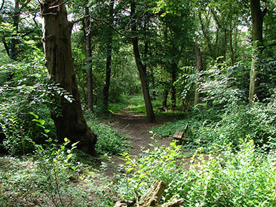
The southern side of the park has a wildflower meadow and more informal native species planting, as well as is a cricket pavilion. On the northern side are football changing rooms.
The park has a hard surface path that runs around some of the perimeter allowing year-round access to the play area, cricket pavilion and changing rooms.
Spring Farm Park play area is located in the north east corner of the Park in a fenced area. The play area was refurbished in 2008 and the equipment caters for a good range of ages.
In the same year, outdoor gym equipment and a multiuse games area was also constructed in the park
Lambs Lane, Rainham RM13 9XF
There is no car park on site.
You can reach the park via the 165 and 287 bus routes.
Opening hours are between 8am and dusk. This park is not currently locked.
Rainham is recorded in the Domesday Book of 1086 as Raineham and is thought to mean 'homestead or village of a man called Regna', formed from an Old English name, and 'hām', meaning settlement.
For much of its history, Rainham was an agricultural settlement, using the River Thames for trade. In the 16th century, industry was limited to a boat-builder and tannery.
There are links between Rainham farms and the City of London from the Middle Ages, and after the wharf was redeveloped in the 1720s, trade increased.
By 1929, most of the farmland had been given over to market gardening. The ferry to London was supplemented with new coaching links in the 18th century and a railway station opened in 1854.
A second wharf was constructed in 1872, and from 1869 there was a growth in industrial development, including chemical and fertiliser factories. The Murex iron-founders moved to Rainham in 1917 and grew along the river, eventually becoming part of the British Oxygen Company.
Away from the river, other industries included brickmaking, and after World War II, there was a growth in gravel extraction - although the area around the park remained agricultural land well into the 20th century.
Spring Cottages are marked on 19th century maps with much of the surrounding area, including the future site of Spring Farm Park, shown as fields.
It is first marked as a recreation ground on the 1939 Ordnance Survey map, following the footprint of the old field to a great extent, while having lost land along the eastern edge. During World War II, the land was used for food production, but in 1946 it was reinstated as a public park.
Little development took place on the park. Pre-war, it was used as a green space for general recreation and winter sports. The main development of the park commenced in the 1950s and continued through into the 1960s.
In the late 1960s, the park had a full time gardener and a park attendant. The park also had public toilets that disappeared when the staff cuts in the 1970’ and 1980s reduced staffing numbers across many parks.
In 2008, there was a refurbishment of the play area, during which the outdoor gym area and multiuse games area was added. Further improvements have been made over the last few years around the pavilions and within the planting scheme in the park.
Play area with equipment for a range of age groups.
Multi-use games area.
There is an outdoor gym on this site.
There are no toilets available on site.
Rainham Cricket Club (Facebook page)


